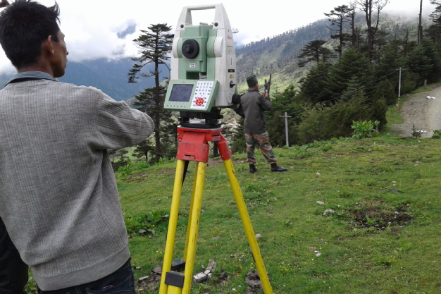
ETS Machine Revolutionizes Land Surveying in Katihar

The Electronic Total Station (ETS) machine, equipped with the ability to measure land parcels within minutes, offers detailed information on land boundaries such as width, length, and distance, covering a radius of 18-20 kilometers.
KATIHAR: Farmers will soon benefit from accessible land registration information, including ‘khatta’, ‘khesra’, and ‘chauhaddi’ (land boundary), with just a single click. The intricate process of measuring land boundaries is set to become a thing of the past as the ETS machine streamlines land measurement tasks.
Survey administrators, kanungo inspectors, settlement officers, and other local representatives in the district have welcomed this decision. Some assert that this technological advancement will be a game-changer in resolving land-related issues such as registration, mutation, land sales, and other related problems.
Understanding the ETS Machine
The ETS machine boasts the capacity to measure over 40 land parcels with 100% accuracy within an 18-20 km radius.
How the ETS Machine Operates
- Step 1: Start the survey or measurement process by considering the land border of three villages to form a tri-junction.
- Step 2: Place a prism at the center of this tri-junction.
- Step 3: Position the ETS machine on the circular dividing line between two villages.
- Step 4: Emit a powerful beam from the ETS machine that hits the prism and returns to the machine.
The returning beam provides precise details about the land’s distance, width, length, and other related information. Notably, the machine functions efficiently even during nighttime and rainy seasons.
Brajkishore Sadanand, District settlement officer, commented, "The ETS machine is capable of measuring land parcels in a few minutes. One can measure the width, length as well as locate the land and the distance to it, within a radius of 18-20 km."
Another officer added, "During the survey, the prism is carried by the ETS operator and two spotting workers. An agency in southern India, previously involved in aerial survey work, has been assigned to conduct a ground check, gathering various land-related information."